
Geography mysteries of places
How to start a faceless geography YouTube channel
"Why X is sitting on the most valuable land" / "Y is hiding something" geography explainers on relief maps.
How Cliptude makes it: Faceless narration + dark satellite maps with glowing outlined places, pinned photos, dated chips
The reference channel: geography (Geographyscoped)
@geographyscoped · joined 2026-06-05 · checked 14 November 2026
Why this niche works
- Geographyscoped is 153 days old and earns about $15,739 a month: 1,420,491 monthly views at an $11.08 RPM, the highest earner in any of our five searches.
- Its 88 videos average 68,841 views, and the best, "Indonesia Is Hiding Something Nobody Talks About", has 944,000.
- It works in repeatable series: the 'most valuable land in human history' and 'isn't really a lake, it's a wound' formats are reused across states and countries (Lake Tahoe 297,000, Lake Superior 280,000).
- The format is proven more than once: a second channel also called 'geography' (189 days) earns about $9,573 a month, and Geography Explored (239 days) about $3,150 at a $14.95 RPM.
Top videos on geography (Geographyscoped)


What a copy could earn
Videos a month × views per video × $11.08 RPM. Illustrations, not promises.
| Slow start | 8 × 4,000 | $355/mo |
| On pace | 12 × 30,000 | $3,989/mo |
| Breakout | 12 × 150,000 | $19,944/mo |
Competition
HighGeography explainers are a hot lane with several channels under a year old earning thousands a month, and they copy each other's title formats. There is room because demand is huge, but you need a sharp question per video and a steady schedule.
| Channel | Subs | Avg views |
|---|---|---|
| geography (UCLzBs6GRIJEzjtrQFGt6zVA) 189 days, same formats and map style, ~$9,573/month |
20,100 | 46,958 |
| Geography Effect 267 days, 'Why X...' economic geography, ~$13,581/month |
32,100 | 134,105 |
| Geography Explored 239 days, US state facts and 'why so few people live in...', ~$3,150/month at $14.95 RPM |
14,100 | 91,676 |
How the Geo Explained Look matches
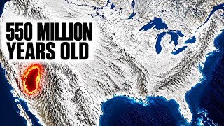
Geographyscoped thumbnails are grey shaded-relief land with bright blue water, white outlined borders, one region filled red or blue, a big white arrow and a two-word caption. Geo Explained matches this closely: one dark satellite map held across a passage with the places that matter outlined in glowing yellow, red for the rival or danger, white caps labels and dated chips, Country border highlight for one border, photos of each place pinned to the map with Map photo pin, and Comparison bar chart for the numbers. The Look is darker and more satellite than their hand-tinted relief, and it does not add the meme arrows.
Make it in Cliptude
- 1Pick the Geo Explained Look and the Faceless documentary format.
- 2Set 15-20 minutes for the channel (8 minutes for tests); one place and one question per video.
- 3Script shape: open on the question, then the land (rivers, mountains, rain), the people, the history that followed the land, and the answer.
- 4In the prompt, list every place in order so Map story can keep one map up ("Cairo, the Delta, Aswan, Lake Nasser, the Western Desert"), and the photos of each place for Map photo pin.
- 5Thumbnail reference: a Geographyscoped thumbnail; relief map, one region filled red, a white arrow, two words.
- 6Title as a question or a hidden-secret hook, e.g. "Why 95% of Egypt Lives on a Strip of Land You Can See From Space".
Geography video title ideas
The formula geography (Geographyscoped) wins with: Why [surprising pattern] in [place], or 25 Wild [country] Facts That Break Your Brain
- Why Almost Everyone in Australia Lives on the Coast
- Why Canada's Population Hugs the US Border
- Why Chile Is So Long and Thin
- Baarle: The Town Split Between Belgium and the Netherlands
- 25 Wild Iceland Facts That Break Your Brain
- Why So Few People Live in Siberia
Fresh titles in the same pattern. Check each story's facts before you script it.
Why Almost All of Egypt Lives on a Thin Green Line
One of the most striking population maps on Earth, explained by one river.
The question
Egypt covers about one million square kilometres, more than three times the size of Italy. Over one hundred million people live there. But look at the country from space at night and almost all of the lights sit on one thin line, running north from the border with Sudan to the Mediterranean, then opening into a fan at the coast. Everything else is dark. About ninety-five percent of Egyptians live within twenty kilometres of the Nile and its delta, on roughly five percent of the land. So why does almost an entire nation live along a single river, and leave the rest of its country nearly empty?
On screen: Map story on the satellite surface: Egypt's border outlined, then the Nile valley outlined in glowing yellow, chips '95% of people' and '5% of land'.
A country without rain
The answer starts with the sky. Egypt is one of the driest countries on Earth. Cairo gets barely an inch of rain in a typical year, and much of the south can go years without any. West of the Nile lies the Western Desert, part of the Sahara, a sea of sand and rock bigger than France. East of the river, the Eastern Desert rises into dry mountains toward the Red Sea. Without rain, there are no farms, no forests and almost no permanent rivers. The only reliable fresh water in the whole country comes from somewhere else entirely, thousands of kilometres to the south.
On screen: Map story outlining the Western Desert and Eastern Desert; Map photo pin of the open desert with the chip 'Cairo: about an inch of rain a year'.
Water from the south
The Nile is one of the longest rivers in the world, about six thousand six hundred kilometres. Its water does not come from Egypt. The White Nile flows from the region of Lake Victoria in East Africa. The Blue Nile rises at Lake Tana in the highlands of Ethiopia, where summer monsoon rains fall in huge amounts. The two meet at Khartoum in Sudan. For thousands of years, those Ethiopian rains sent a flood down the river every summer. The flood spread across the valley in Egypt and left behind a layer of rich black silt. That silt was the soil that fed one of the oldest civilizations on Earth.
On screen: Map story panning from Egypt to Lake Victoria and Lake Tana, tracing the White and Blue Nile to Khartoum with a chip for each lake.
The gift of the Nile
The Greek historian Herodotus called Egypt the gift of the Nile, and the map shows why. In the south the green valley is often only a few kilometres wide, with desert cliffs on both sides. You can stand in a field of wheat and see sand dunes. North of Cairo, the river splits into two main branches, toward Rosetta and Damietta, and spreads out into the delta, a wide triangle of farmland. Towns, roads, railways and farms are packed into this narrow strip. Population density here is among the highest of any farming region in the world, while the desert beside it stays almost empty.
On screen: Map story down the valley at Luxor with the narrow green strip outlined, then a pan north to the delta; Map photo pin photos at Rosetta and Damietta.
Taming the flood
The flood was both a blessing and a danger. A weak flood meant hunger, a strong one could wash away villages. In the twentieth century Egypt decided to control it. The Aswan High Dam was completed in 1970. Behind it formed Lake Nasser, one of the largest artificial lakes in the world, stretching south into Sudan. The dam ended the yearly flood, let farmers grow crops all year, and produced electricity. But it also trapped the silt. Today farmers use chemical fertilizer instead, and parts of the delta coast are eroding because the river no longer brings new soil to rebuild it.
On screen: Map story centred on Aswan, chip '1970', Lake Nasser outlined into Sudan; Map photo pin of the dam; the eroding delta coast marked red.
Trying to leave the river
With over one hundred million people on so little land, Egypt has tried for decades to move people into the desert. It has built new towns around Cairo and new farming projects in the Western Desert, pumping water from the river or from deep underground. The largest project is the New Administrative Capital, a planned city rising in the desert east of Cairo. But every desert city still depends on water from the Nile. And upstream, Ethiopia has built a giant dam on the Blue Nile, which has made Egypt's dependence on the river a major international issue. The thin green line is also a lifeline.
On screen: Map story of the new desert cities around Cairo; a pan to the Blue Nile dam site in Ethiopia outlined in red; Map photo pin of the dam.
The answer
So why does almost all of Egypt live on a thin green line? Because there is almost no rain, and the only dependable water flows in from Ethiopia and East Africa down one river. Where the Nile reaches, there is soil, food and life. Where it does not, there is desert. Seven thousand years of history, from the pharaohs to the modern megacity of Cairo, have played out on that same strip of land. When you see Egypt lit up from space, you are not looking at a country's border. You are looking at the shape of a river. Next time: another map that only makes sense once you see the land.
On screen: Map story pulling back to the whole of Egypt; closing chip 'The shape of a river'.
Geography channel questions
How many views does a geography channel need to make $2,000 a month?
At the $11.08 RPM estimated for geography (Geographyscoped), about 180,505 long-form views a month make $2,000 from AdSense. That is roughly 3 videos at this channel's average of 68,841 views each.
How much does a geography YouTube channel make?
geography (Geographyscoped) is 153 days old with 19,500 subscribers and earns an estimated $15,739 a month from 1,420,491 monthly views. Sponsorships and affiliate income come on top of that.
Is geography a good YouTube niche in 2026?
Competition is high. Geography explainers are a hot lane with several channels under a year old earning thousands a month, and they copy each other's title formats. There is room because demand is huge, but you need a sharp question per video and a steady schedule. Channels to study: geography (UCLzBs6GRIJEzjtrQFGt6zVA), Geography Effect, Geography Explored.
Can you make geography videos without showing your face?
Yes. In Cliptude, the Geo Explained Look makes these videos from a script, with no presenter on camera: faceless narration, dark satellite maps with glowing outlined places, pinned photos, dated chips.
Make your first video in this niche
Open the Geo Explained Look, paste the script above or your own topic, and Cliptude builds the narration, footage and on-screen boards.
Sources
- https://socialblade.com/youtube/channel/UCzHIoLdss_1M_Iw6OxRKKEg
- https://www.youtube.com/channel/UCzHIoLdss_1M_Iw6OxRKKEg/videos
- https://www.cia.gov/the-world-factbook/about/archives/2022/countries/egypt
- https://www.fao.org/fileadmin/user_upload/aquastat/pdf_files/EGY_egypt_cp.pdf
- https://en.wikipedia.org/wiki/Aswan_Dam
- niche-playbook/research/C/s06-geography-explained.network-response
- niche-playbook/research/C/ca17-geography.network-response
- niche-playbook/research/C/daily17-geography.network-response
Figures are estimates checked 14 November 2026, cross-checked on Social Blade and YouTube. Revenue is AdSense only and real RPM varies. Channel names and video titles belong to their owners; Cliptude is not connected to any channel listed. All 26 niches